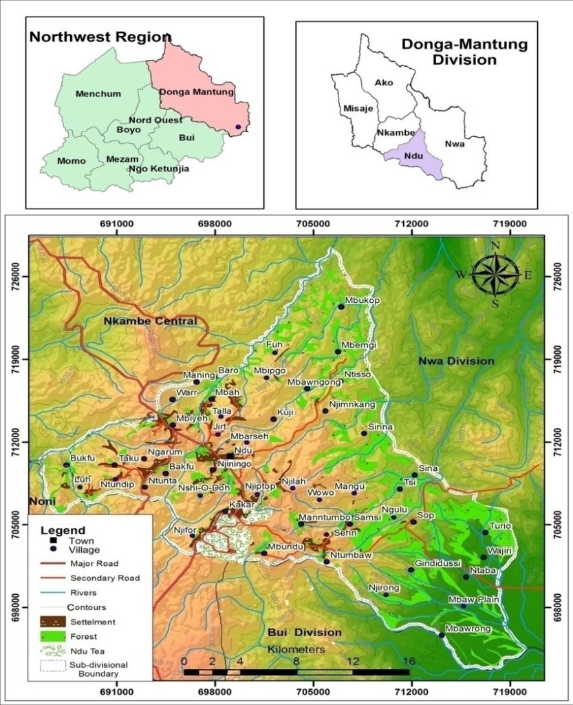
Established on September 1st, 1992, by Decree No. 92/187, the Ndu Rural Council has served the community of Ndu for over three decades. The council’s headquarters are located approximately 145 km from Bamenda, providing a central administrative hub for the region. The council’s jurisdiction encompasses a geographically diverse area, encompassing 17 villages strategically organized into three distinct zones to facilitate efficient governance and service delivery. These zones are: the Centre Zone (comprising Ndu, Mbipgo, Njimkang, Njilah, and Wowo villages); the West Zone (encompassing Talla, Ngarum, Taku, Ntundip, and Luh villages); and the East Zone (including Sehn, Ntumbaw, Njirong, Ngulu, Nseh Macop, Sinna, and Sop villages).
Ndu’s strategic location places it at the crossroads of Nwa, Kumbo Central, and Nkambe Central Sub-Divisions. Its boundaries extend north to Nkambe, south to Mbiame (Bui Division), southwest to Nkum Sub-Division (Bui Division), west to Noni Sub-Division (Bui Division), and east to Nwa Sub-Division. This central position underscores the council’s vital role in connecting and supporting these neighboring communities. The significant presence of the Ndu Tea Estate within the council’s area highlights the importance of agriculture and industry within the local economy.
The current mandate of the Ndu Rural Council is represented by a body of 25 municipal councillors, actively working to address the needs and aspirations of the community. This elected body is responsible for overseeing the council’s operations, ensuring effective resource management, and implementing projects designed to foster sustainable development and improve the quality of life for all residents. For inquiries, please contact us at PO Box 52, Ndu.